At an altitude of 2,260 metres (7,410 ft) and located 90 kilometres (56 miles) west of Guatemala City, Iximche was the capital of the Late Post-classic Kaqchikel Maya Kingdom (the capital of one of the indigenous Maya peoples of the mid-western highlands in Guatemala) from 1470 until its abandonment in 1524.
For many years, the Kaqchikel served as allies of the K'iche' Maya, but the growing power of the Kaqchikel eventually caused a rift, and the Kaqchikel were forced to flee the K'iche' capital and established their own new capital. This was on an easily defensible ridge surrounded by deep ravines. Developing quickly as a city, within 50 years it had reached its height. For a number of years the K'iche' left the Kaqchikel in peace, but this was to change, and resulted in conflict which was to continue until 1491 when the K'iche' where defeated by the Kaqchikel.
When the Spanish conquistadors arrived in Mexico, the Aztec emperor sent messengers to warn the Kaqchikel of the danger. After the Aztec defeat, the Kaqchikel offered an alliance with the Spanish. When the Spanish arrived in Iximche in 1524 the Kaqchikel provided them with native allies to assist in the conquest of the other highland Maya Kingdoms and Iximche was declared the first Spanish capital of the Mesoamerican region in the same year.
Due to excessive Spanish demands for tribute, the Kaqchikel soon broke the alliance and deserted Iximche, which was burned by the Spanish. Hostilities were to continue until 1530 when the Kaqchikel finally surrendered.
The ruins of Iximche were first described in the late 17th century. They were visited during the 19th century by scholars who published plans and descriptions, but it was not until the 1940s that serious investigations of the site started, and these were to continue sporadically until the early 1970s. In 1980, during the Guatemalan Civil War (1960 to 1996), a meeting between guerrillas and Maya leaders took place at the ruins, which resulted in the guerrillas declaring that they would defend indigenous rights.
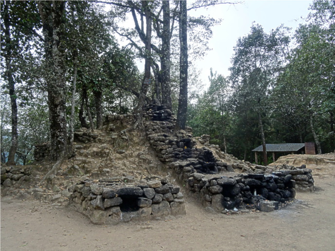
The ruins of Iximche were declared a Guatemalan National Monument in the 1960s and a ritual was carried out at the site in 1989 in order to re-establish the ruins as a sacred place for Maya ceremonies. These ceremonies are still carried out there today. The set of altars, used in present-day Mayan ceremonies can be found at the far end of the site, and offerings such as flowers, fruit and drinks can be seen there.
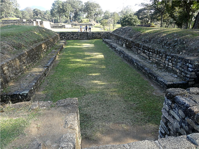
Well over a hundred structures have been located at Iximche, which is composed of four large plazas strung out along a ridge and protected by a deep moat. Buildings include palaces, numerous pyramid temples and residences and a couple of ball courts, both of which are of similar size and shape.
The city centre was fortified, its access being through only the one entrance over a bridge spanning an 8-metre-deep artificial ditch. At the entrance is a stela which commemorates the end of the 13th Oxlajuj Baktun, which occurred on the 21st December 2012. Buried near the stela is a time capsule which contains documents to be read at the end of the present Oxlajuj Baktun, which will be in the year 2407. The inscription of 8o glyths covers five key events in the history of the Maya people and three key events in the history of the Kaqchikel nation and directs the indigenous peoples of Guatemala not to forget their knowledge and heritage.
Plaza A is a wide open plaza which can accomodate many people, and was used for public activities including political, religious and recreational activities. Around the open space is a ball court, some temple-pyramids, various buildings and altars.
The Xajil Palace could have been the residence of the Xajil family. Archaeological evidence indicates a greater number of domestic activities than religious activities took place there.
Plaza B consists of an open space before the Zotzlil Palace. It consists of temples and altars for ritual activity and contained buildings with multi-rooms for political and administrative activities.
Plaza D consists of a wide space completely surrounded by buildings, although very little is known about it. It is thought to have been used for political, religious and recreational activities, and the remains of a palace are located on the south west side of the plaza.
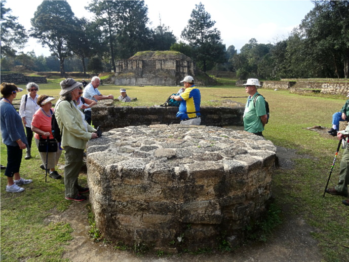
Excavations have uncovered the poorly preserved remains of painted murals on some of the buildings and evidence of human sacrifice. The circular stone platform seen on the site is believed to have been used for sacrifices.
The site has a small museum displaying a number of pieces found there, including sculptures and ceramics and a model of the site as it would have been at its height.
To see more photographs and take a virtual tour of the site click on the photoshow below.