|
|
Located close to the northern coast of the Yucatan, Dzibilchaltun was one of the oldest and most populated settlements in the Yucatan.
Dzibilchaltun means place where there is writing on flat stone. The population maintained themselves with a maritime and coastal economy in addition to agriculture. It is believed that the site was inhabited from around 300BC until the Spanish conquest. The site was at its height during the Late Classic period (600-900 AD) when it had a population of 20,000 inhabitants (although this has been put as high as 40,000) and covered an area of approximately 9 sq kms.
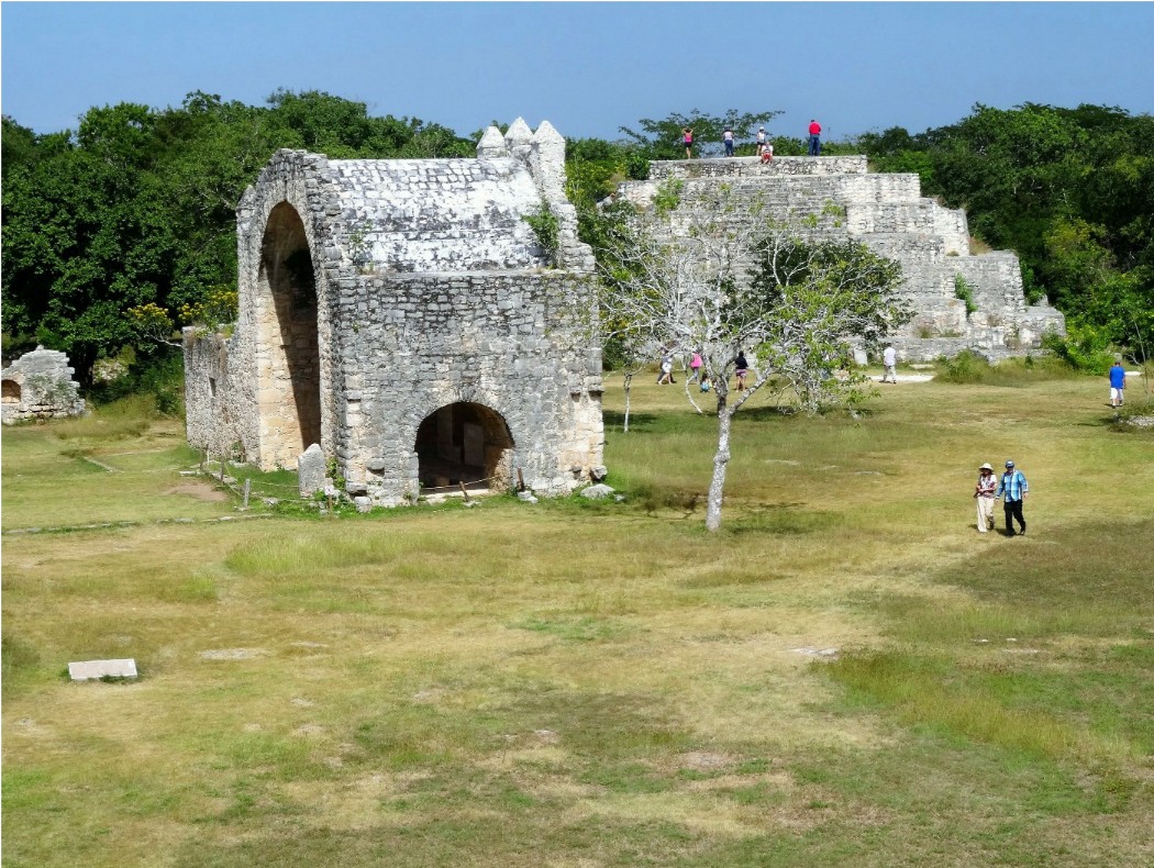
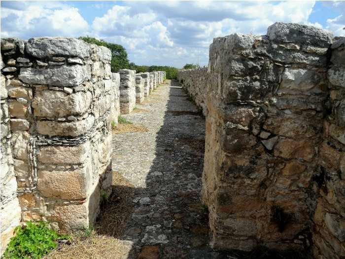
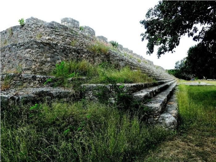
Its design consists of small groups of buildings which are connected by roads. The central zone covers an area of 3 sq kms and comprises a large square. This area was used by the elite and consisted of administrative and religious buildings as well as the square used for ceremonial occasions. The square is over 12,000 sq metres and was originally covered in stucco, although virtually none of this remains today. It is surrounded by a number of buildings, whose stairs all face the centre of the square. These buildings date from 600 1000 AD except for two smaller buildings located at the north which date from 1000-1200 AD. The square also includes building 44, which at 130 metres long is probably the longest series of steps in Mesoamerica. These buildings, which were constructed during four periods of construction, also had additional work carried out. The buildings were used during 600-1000 in relation to the rites carried out in the square.
In the centre of the square is a colonial open Christian chapel with a vault and sacristy, which dates from the late 16th century. Its exact year of construction is not known although a stone is engraved with the date 1539. A number of the stones used for construction are known to have been taken from pre-Hispanic buildings. This construction indicates the importance of the site following the arrival of the Spanish. Also in the square are the remains of a cattle range whose origins go back to the 17th century.
Also in the square is a pyramidal structure although it does not contain any remains of a temple which would usually be associated with this type of building. A stela was found at this location which is now displayed in the on-site museum but has a copy of the stela where it was found.
Leading off from the square in a western direction is a road leading to the Cenote, which measures approximately 100 x 200 metres and which today is used by visitors for swimming and recreation. Continuing along this road is the ball court, which is a common area in all Maya sites.
Leading from the eastern side of the central square is a road 20 metres wide which runs for 400 metres to a building known as the Temple of the Seven Dolls, named after the seven rough figures of clay found there, although other artefacts, which included offerings such as shell, fish bone and obsidian were also found there.
This temple was very important in relation to astronomical functions and at the equinox and solstices, the sun shines directly through its doors and windows.
In front of this building is a platform which contains a stela. It is believed that this was originally covered with stucco but as a result of weathering over the years is now smooth; as in fact are the other 19 stelae on the site.
Dzibilchaltun is also an eco-archaeological park and is a good location at which to observe birds and animals.
The site, like most of the Maya sites, has not been fully excavated and it is expected that much has yet to be discovered, with many parts not yet open to the public.
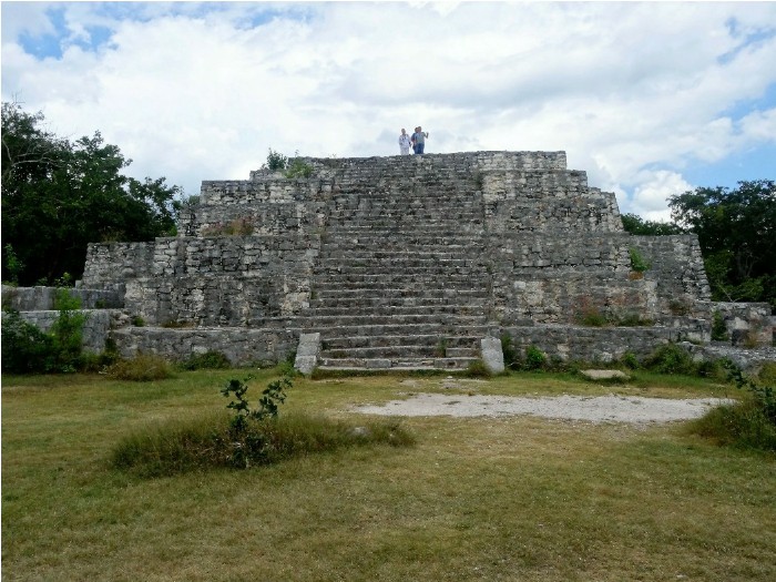
Pyramidal structure in Main Square
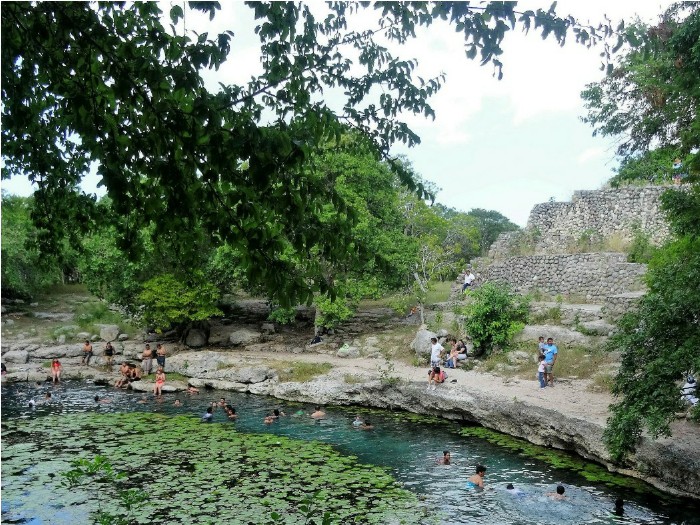
The Cenote
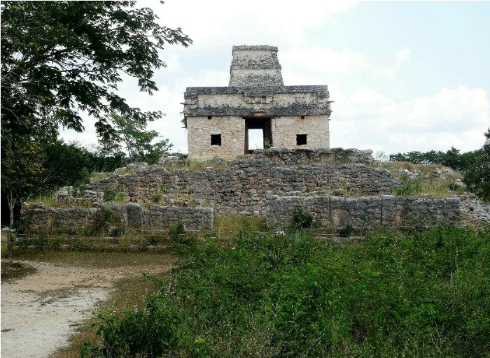
The Temple of the Seven Dolls,
To see more photographs and take a virtual tour of the site click on the photoshow below.

| Site Map |